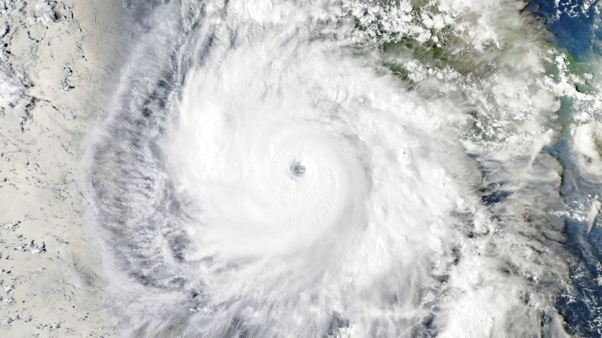
Hurricane Isaias makes US Gulf Coast landfall while Hurricane Simon nears Mexico
Isaias struck the Florida Panhandle and moved northward, while Simon, a Category 4 storm, is expected to make landfall on Mexico's western coast later this weekend.
By Felo News Desk · Published
Hurricane Isaias made landfall on Friday as a Category 2 storm near Destin, Florida, and quickly weakened as it moved northward, while Hurricane Simon, a Category 4 system with 145 mph winds, is projected to hit Mexico's western coast on Saturday or Sunday, according to the U.S. National Hurricane Center.
What happened
Isaias struck the Gulf Coast on Friday, bringing hurricane‑force winds to the low‑lying shoreline of the Florida Panhandle. The National Hurricane Center later classified the system as a post‑tropical cyclone as it traveled north across Alabama and into the Tennessee Valley. More than 726,000 residents in Alabama and the Florida Panhandle lost power after the storm’s impact.
Simon is currently a Category 4 hurricane with sustained winds of 145 mph (230 kph). The centre in Miami warns that the storm could make landfall on Mexico’s western coast later on Saturday or early Sunday, bringing 10‑20 inches of rain, with isolated totals up to 30 inches. A hurricane warning is in effect from Punta San Telmo to Punta Mita, Punta Mita to El Roblito, and Las Islas Marias.
What the reports add
The Independent’s live tracker for Isaias notes that, after landfall, the storm is expected to continue weakening but still produce gusty winds inland and a “life‑threatening” storm surge for parts of the Florida Panhandle. It also warns of possible tornadoes across the Panhandle, Georgia and the Carolinas.
For Simon, the same outlet reports that the storm could generate “life‑threatening” flooding and mudslides, especially in southwestern Mexican states such as Jalisco, Michoacán, Colima and Nayarit. The forecast also highlights the potential for extreme wind damage before the eye makes landfall.
What was said
The National Hurricane Center, as quoted by the Independent, warned residents of the Mexican coast to “take urgent action to prepare” for Simon’s rapid intensification and extreme weather. The centre also cautioned that severe winds could arrive before the storm’s eye makes landfall.
In the United States, the National Hurricane Center’s latest advisory described Isaias as having “quickly moved north through Alabama as its wind speeds dropped sharply,” and highlighted the risk of tornadoes and storm surge for the Gulf Coast.
How it came about
Isaias was first identified as a tropical storm on October 7, when Felo News reported its potential to become the season’s first hurricane and target the Gulf Coast (Felo article). By October 9, the storm had strengthened to a Category 1 hurricane and was moving east‑northeast, prompting widespread warnings. Simon, by contrast, developed later in the season and rapidly intensified to Category 4, prompting immediate alerts for Mexico’s western shoreline.
Key facts
- Hurricane Isaias made landfall near Destin, Florida as a Category 2 storm on Friday. (independent.co.uk)
- More than 726,000 people in Alabama and the Florida Panhandle lost power after Isaias. (independent.co.uk)
- Isaias weakened to a post‑tropical cyclone while moving north across Alabama. (independent.co.uk)
- Hurricane Simon is a Category 4 hurricane with 145 mph winds, expected to hit Mexico's western coast Saturday or Sunday. (independent.co.uk)
- Simon could bring 10‑20 inches of rain, with isolated amounts up to 30 inches, causing flooding and mudslides. (independent.co.uk)
Timeline
- 2026-10-07 — Felo News reported Isaias as a potential first hurricane of the season targeting the Gulf Coast.
- 2026-10-09 — Felo News noted Isaias strengthening to Category 1 and moving east‑northeast with surge and tornado warnings.
- 2026-10-10 — Isaias made landfall as Category 2; Simon intensified to Category 4 and approached Mexico.